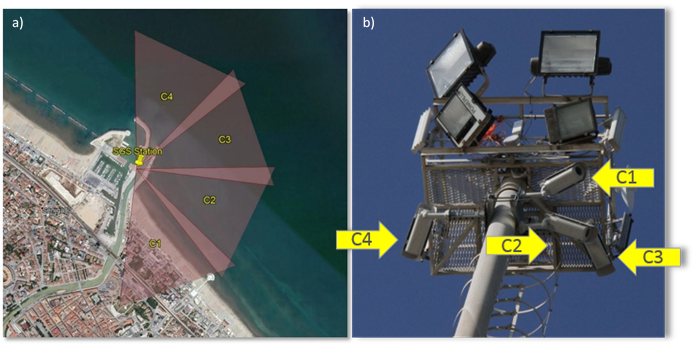
The SGS station is a video-monitoring system designed to acquire useful information to study the nearshore area of a typical beach along the Middle Adriatic Sea. Indeed, its particular location allows observing both the unprotected beach located south of the harbor and the estuary of the Misa River..

he station is named Sena Gallica Speculator (SGS) from the Latin name of this site and it was installed in July 2015 as part of the Estuarine Cohesive Sediments (EsCoSed) project. The objective of the EsCoSed project was to better understand coastal, estuarine, and riverine processes at the Misa River mouth. The SGS station is also part of the Coastal Imaging Research Network (CIRN).
The SGS is located at the North pier of the Senigallia harbor and it is mainly composed of four cameras located on the top of a tower, at 25m above mean sea level. Three cameras face South, toward the 500 m long unprotected beach between the harbor jetty and the Rotonda pier. The fourth camera faces northward, toward the estuary of the Misa River.

For each recording hour, the data collected from each camera consists of a ten-minute video (collected at 2Hz) and a snapshot. The acquisition occurs during daylight hours, from 5:00 AM to 5:00 PM UTC, for a total of thirteen videos and thirteen snapshots a day, for each camera.
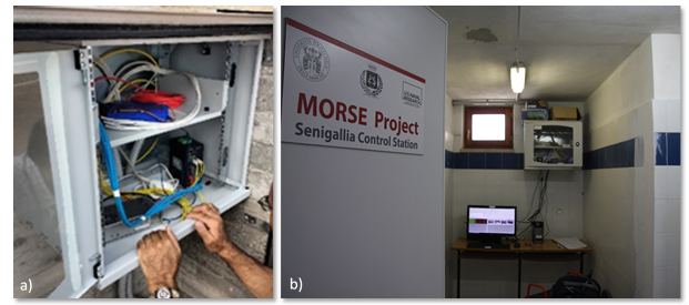
Through a pair of cables, the camera system is connected to a communication box where an external trigger synchronizes the camera acquisition. Then, through optical fibers, the system is linked to a computer, located in the new MORSE office, used to control the data collection and archive. Videos and snapshots are finally automatically stored in on a repository server located at the Università Politecnica delle Marche.

A large amount of data is already available since the gaps in the data collected from the SGS station were around 20% of the total number of days.
POST-PROCESSING
The hourly videos and snapshots recorded from the SGS station are post-processed using available toolboxes and some custom Matlab Codes.
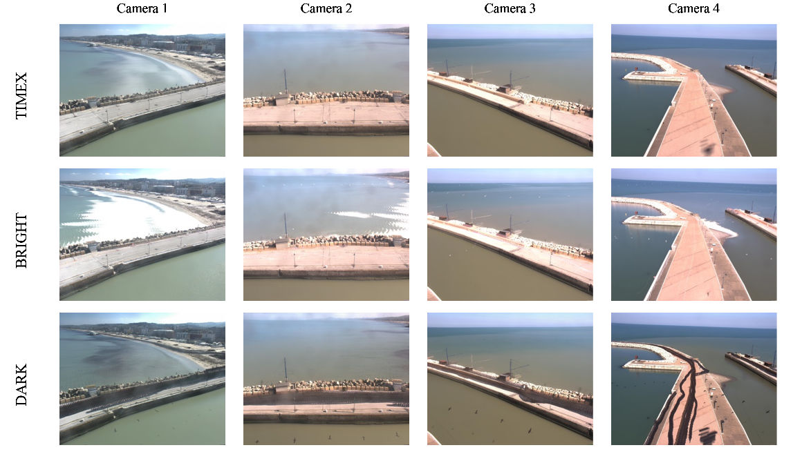
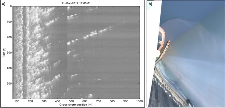
First, the videos of each hour and each camera, are elaborated to obtain a 10-minute time-exposure image (Timex), a darkest image (Dark), a brightest image (Bright) and a full-time series from the recorded period for a selected grid of pixels (Timestack). In a second step, the processed images, together with the snapshots, are merged and ortho-rectified to obtain others five products per hour: a panoramic image and four (snapshot, time-exposure, darkest and brightest) plan-view images.
All these productions generate a continuously updated database useful for further specific analyses.


